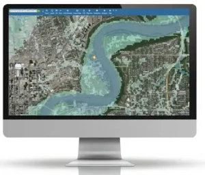
Maps have always been a crucial part of human life (any Gen Xers remember Mapquest?). Today, Geographic Information Systems (GIS) have revolutionized mapping by making them highly precise and interactive. At the heart of GIS lies geocoding—a process that converts addresses into geographic coordinates. It will take an address like “1600 Amphitheatre Parkway, Mountain View, CA” and translate its geographic coordinates to latitude 37.423021 and longitude -122.083739, which you can use to place markers on a map or position the map. Understanding geocoding and its relationship with GIS can help anyone who works with location data to ensure they are using precise and accurate information.
What is Geocoding?
At its core, geocoding transforms textual location descriptions, like a restaurant name, into precise geographical coordinates, making geocoding a critical tool for various fields such as urban planning, logistics, marketing, and disaster response. Essentially, geocoding translates human-readable information into a language that computers and mapping software can understand and utilize for an output.
For example, a delivery company can use geocoding to convert addresses into coordinates for route optimization, ensuring efficient delivery schedules and reducing fuel consumption. Moreover, businesses can use geocoding to target marketing efforts more precisely. By converting customer addresses into geographic coordinates, companies can analyze and segment their customer base by location, creating more targeted and effective marketing campaigns.
Geocoding Works in the Background to Make Your Life Easier
1. Navigation and Ride-Sharing Services
When you use Google Maps to find the fastest route to the office or call an Uber to get across town, geocoding is at work. It takes the address you provide and converts it into coordinates, guiding you or your driver precisely to the destination. This seamless process ensures you reach your location without getting lost, making your daily commutes more efficient.
2. Delivery Services
Companies like Amazon, FedEx, and UPS rely heavily on geocoding to ensure packages are delivered to the correct addresses. By converting street addresses into precise coordinates, these companies can optimize delivery routes, reduce errors, and provide real-time tracking updates. This efficiency means faster deliveries and happier customers.
3. Enhanced Shopping Experience
Have you ever tracked an online order from the warehouse to your doorstep? Geocoding makes this possible by translating your address into coordinates that logistics systems can understand. This leads to more efficient routing, faster deliveries, and fewer lost packages, enhancing your overall shopping experience.
4. Emergency Services
In emergencies, every second counts. When you call 911, geocoding helps dispatchers pinpoint your location quickly, even if you’re unsure of your exact address. This capability is crucial for getting help to you swiftly, whether it’s for a medical emergency, fire, or other urgent situations.
“Most geocoders will return a location, a confidence score providing confidence that the correct location was found and a precision code stating how precise the location is. LightBox uses machine learning to continually improve matching and while we also provide the confidence score and a precision code, we also provide IDs that are used to pull back related property information.”
Skip Cody, Product Manager, LightBox APIs

Geocoding vs. GIS
While geocoding is a vital component of GIS, they are not synonymous. GIS is a broader system designed to capture, store, manipulate, analyze, manage, and present spatial or geographic data. It integrates various data types and tools, including geocoding, to provide a comprehensive spatial analysis framework.
Key Differences:
- Scope: Geocoding focuses specifically on converting addresses to coordinates, whereas GIS encompasses a wider range of spatial data processing and analysis functions.
- Functionality: Geocoding is a singular function often used within GIS. GIS, however, combines multiple functions such as data visualization, spatial analysis, and data management.
- Applications: While geocoding is often used for tasks requiring location conversion, GIS applications extend to environmental management, urban planning, transportation networks, and more complex spatial analyses.
Geocoding is an essential process for transforming address data into geographic coordinates, enabling a multitude of applications in navigation, emergency response, and data analysis. It serves as a crucial element within the broader and more versatile GIS, which offers comprehensive tools for spatial data management and analysis. Understanding both geocoding and GIS allows for better utilization of geographic data in various professional fields.
The Broader Impact
Geocoding doesn’t just make life more convenient; it also underpins critical infrastructure and services. Urban planners use it to design efficient cities, businesses rely on it to reach customers, and governments use it for everything from census data collection to disaster response.
By bridging the gap between human language and digital mapping, geocoding is the invisible force working in the background of our everyday lives that makes our daily movements connected, safer, and more efficient.
Stay tuned for follow up pieces on specific geocoding use cases in real estate, infrastructure, and technology.
