Analysis & Mapping Tools
Turn Environmental Data into Actionable Insight
Environmental due diligence isn’t just about accessing data. It’s about interpreting it efficiently.
LightBox Live’s integrated analysis and mapping tools are designed to help environmental professionals get more value from the environmental reports, historical resources, and property data they rely on every day. By making it easier to visualize site conditions, focus on the records that matter most, evaluate potential environmental concerns, and document findings, these tools help users move from data to insight faster
Key Benefits
More Than a Map Viewer
Transform the map into an interactive workspace where you can analyze, visualize, and refine environmental and historical data throughout the due diligence process.
Focus Your Review
Filter, measure, and visualize the records most relevant to your site, reducing time spent sorting through unnecessary information.
Support Better Documentation
Create maps, export tables to excel, and generate reports that are easy to share and incorporate into deliverables.
Environmental Analysis Tools
Area of Interest (AOI)
Quickly identify adjoining properties.
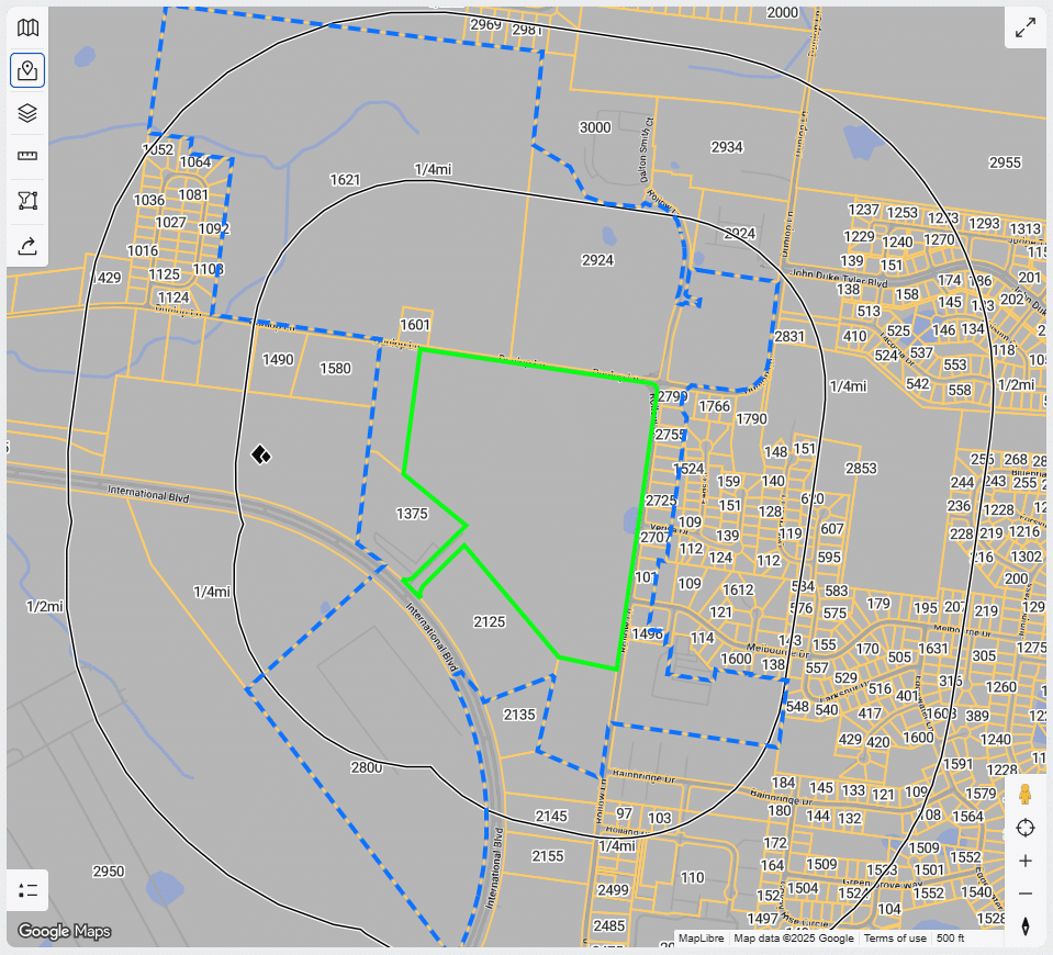
The Area of Interest (AOI) tool helps environmental professionals identify adjoining properties using an interactive, map-based workflow. Built around the adjoining property definition in ASTM E1527-21, the tool leverages LightBox’s connected parcel, ownership, building footprint, and street network data to identify adjoining parcels and display environmental records within the selected area. Users can also create custom buffers, compare results across multiple map layers, and export findings to support environmental due diligence documentation.
Vapor Encroachment Condition (VEC)
Evaluate potential vapor migration concerns with greater confidence.
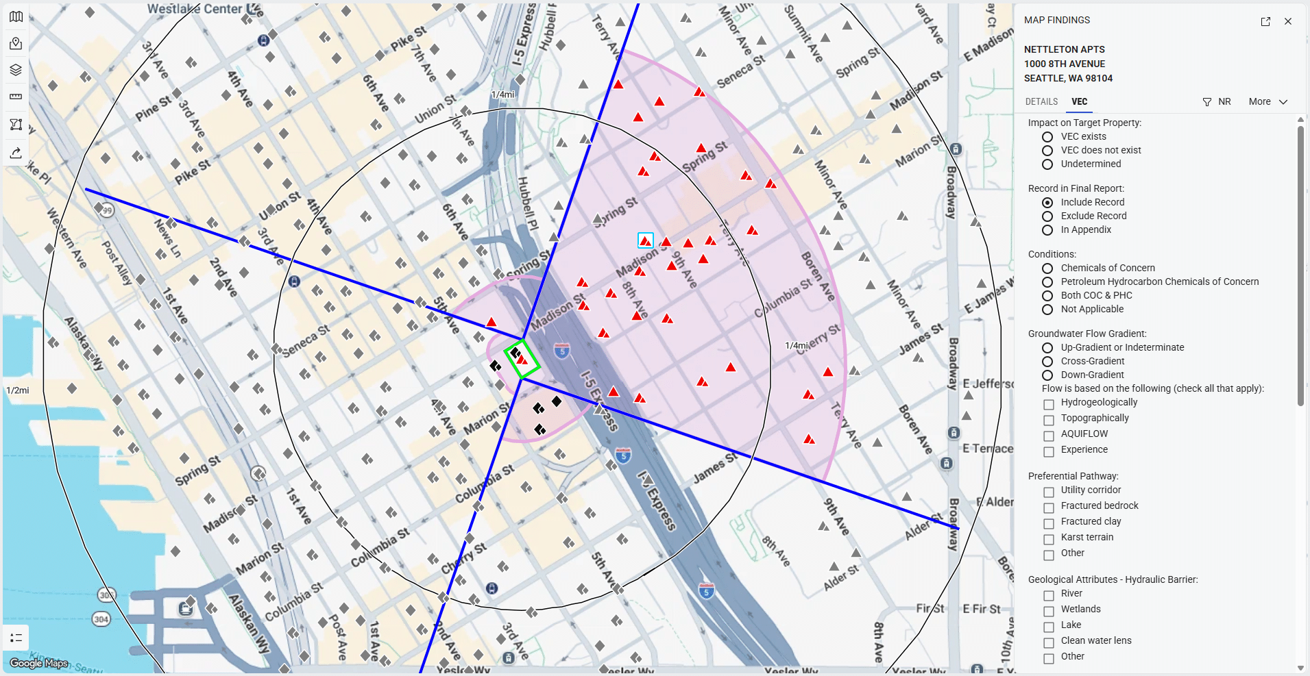
The Vapor Encroachment Condition (VEC) App supports vapor encroachment screening through an interactive workflow aligned with ASTM E2600, the Standard Guide for Vapor Encroachment Screening on Property Involved in Real Estate Transactions. By combining environmental records, mapping, and built-in analytical tools, the application helps environmental professionals evaluate potential vapor migration concerns, document their findings, and generate a customized screening report.
Groundwater Flow
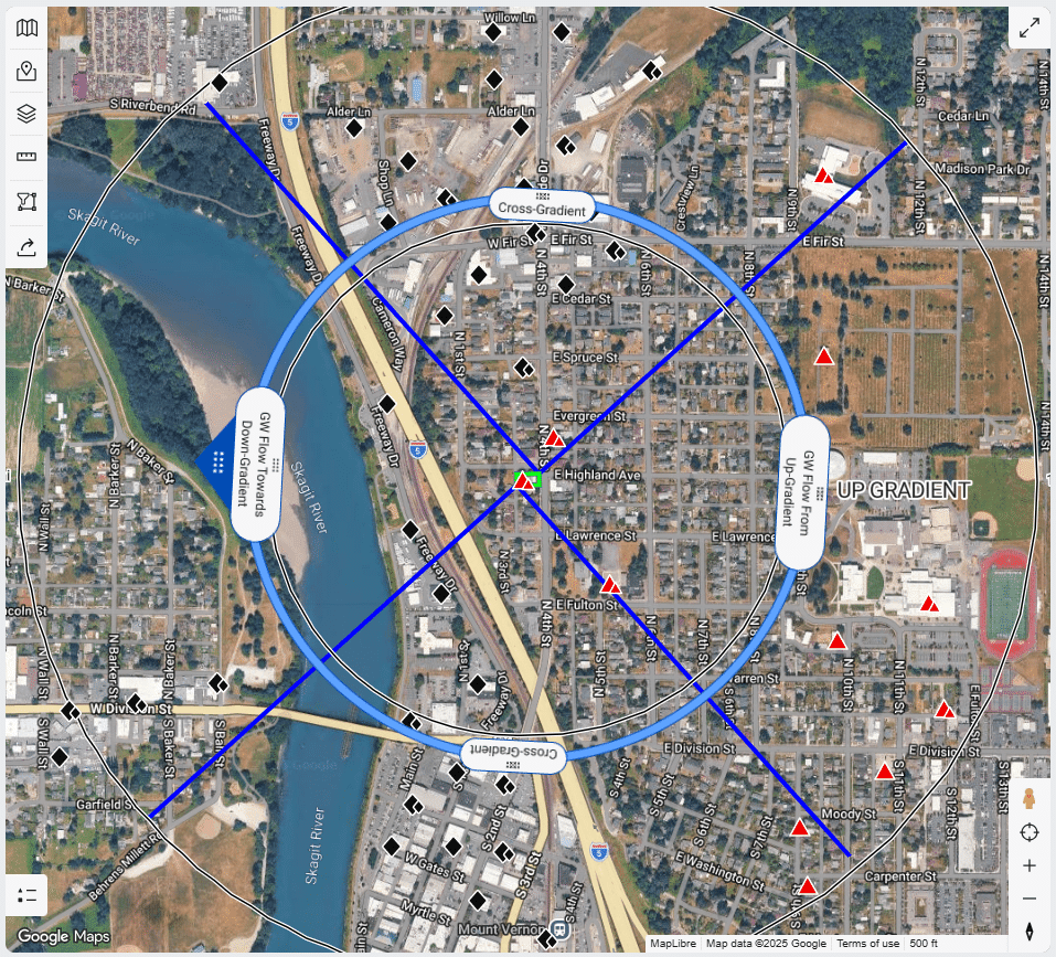
Prioritize environmental records based on estimated groundwater flow.
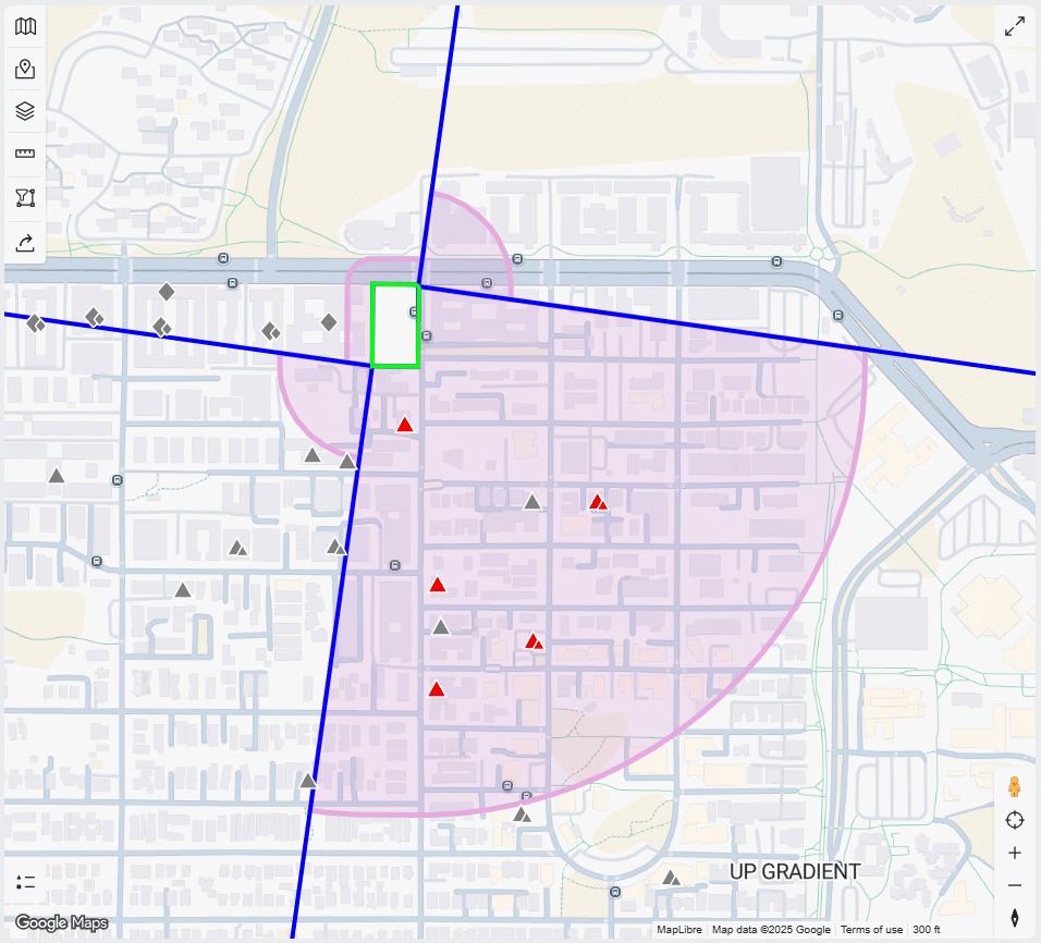
The Groundwater Flow tool supports groundwater migration screening by estimating groundwater flow direction relative to the subject property and organizing environmental records as upgradient, cross-gradient, or downgradient. Users can adjust flow direction based on available site information, helping focus attention on the records most likely to warrant additional evaluation during environmental due diligence.
FieldCheck
Refine your report before it’s finalized.
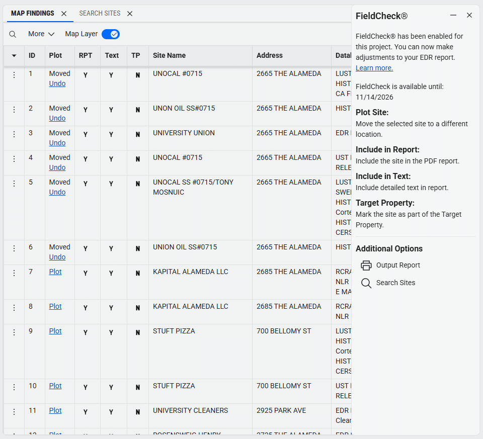
FieldCheck gives environmental professionals greater control over Radius Map results by allowing them to review and refine mapped environmental records before generating the final report. Users can identify the target property, reposition records, add previously unplotted sites, search for additional records, or remove records when appropriate. Once approved, updates can be incorporated into a revised report, helping ensure mapped environmental records accurately reflect your site evaluation before the report is finalized..
Map Tools
LightBox Live includes a suite of interactive mapping tools that help environmental professionals focus their review, analyze site conditions, and create project-ready deliverables.
Geometry Filter
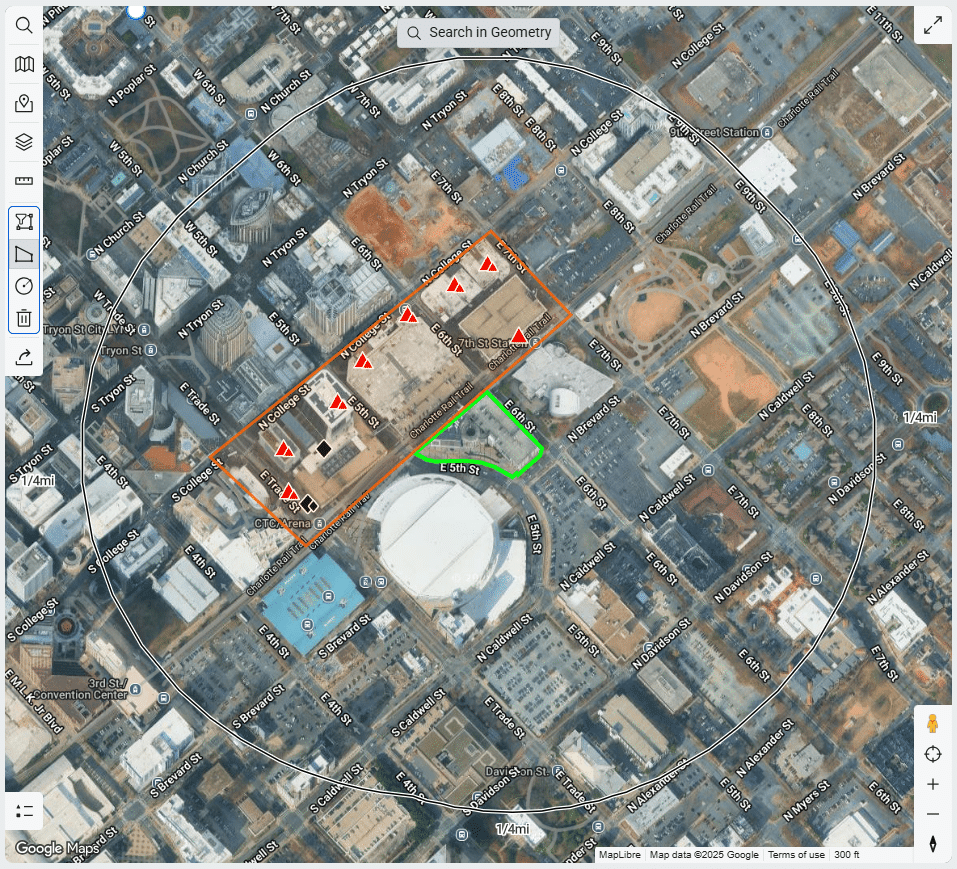
Draw a custom polygon or circle to focus your review on a specific area of the map. The Geometry Filter displays only the records within the selected area, making it easier to isolate locations of interest and focus on the information most relevant to your assessment.
Measure
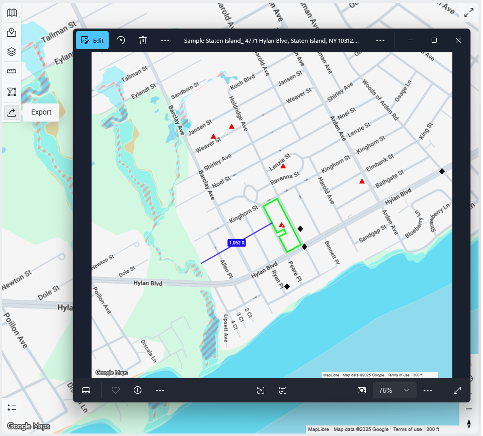
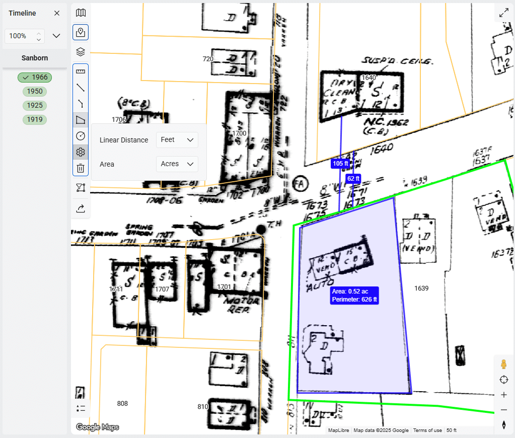
Calculate distances and areas directly within the map to better understand property relationships, verify separation distances, and document site characteristics. Customize measurement units to match your project needs, with measurements automatically saved as map layers for reference throughout your analysis.
Export
Create high-quality PNG images of your current map view, including active layers, annotations, and analysis results. Exported maps are ideal for project documentation, presentations, and environmental reports.